
Trace a Grand Island Street
The useful question is usually narrower than a list of everyone on a road. An address can lead to a parcel, a recorded instrument, a permit request, or a historical household reference, and each source answers a different question. Hall County keeps those records with separate custodians. The property record helps anchor the place. The deed index supplies recorded land evidence. Older directory and map sources can then place an address in its period.
Keep the parcel number, situs address, legal description, source URL, and access date together. That small record trail makes it clear whether a result concerns the same property. It also avoids treating a current owner string or a name match as proof that someone now lives there.
- Validate the exact address, then search the Hall County Assessor portal by address, parcel number, legal description, or name as the form allows.
- Open the Hall County and Grand Island parcel viewer, click the parcel, and record its parcel ID, situs, legal description, and access date.
- Use the Register of Deeds instrument search with the legal description when a name search is unclear. Read the recording date and document type before drawing conclusions.
- For a lawful current-registration question, use Nebraska Voter Check as a current registration and polling-site tool, not as a street-by-street roster.
- For an older household, confirm the exact title and year of a reverse or criss-cross directory with the Grand Island Heritage Room.
Note: A street address is a starting point, not a finding about every person connected with that address.
Grand Island Street Assessor Filters
The Assessor search is the strongest first screen for a modern Grand Island address. Its form accepts Parcel #, Legal Contains, Name Contains, and Address Contains. It also offers property-location choices, sale-date selectors, price range, property type, status, and lot-size controls. There is no ZIP control in the inspected form, so a ZIP should not be used as a substitute for an address or parcel search.
Use the most specific field available. An address search can identify a candidate parcel, while a legal-description or parcel-number search helps when street spelling, a unit number, or a change in mailing practice creates a mismatch. The sale-year selector includes a listed 1948 option and later choices through 2029, but that selector does not establish full online coverage from 1948. No official portal instructions for result export or certified parcel-card download were located.
| Hall County Assessor field | How it narrows a street search | Important limit |
|---|---|---|
| Address Contains | Finds a candidate situs address on the named street. | Match it to the parcel ID before relying on it. |
| Parcel # | Targets the stable parcel identifier. | Use the GIS popup to cross-check the address. |
| Legal Contains | Connects a parcel to deed-search terms. | Legal text may be more useful than a surname. |
| Name Contains | Provides a property-record lead when a name is known. | It is not proof of current residence. |
| Sale date and property filters | Refines a parcel or sale set by record characteristics. | There is no ZIP filter or documented export control. |
The Hall County assessment search shows the available address, sale, and classification controls used for this part of a Grand Island street directory search.
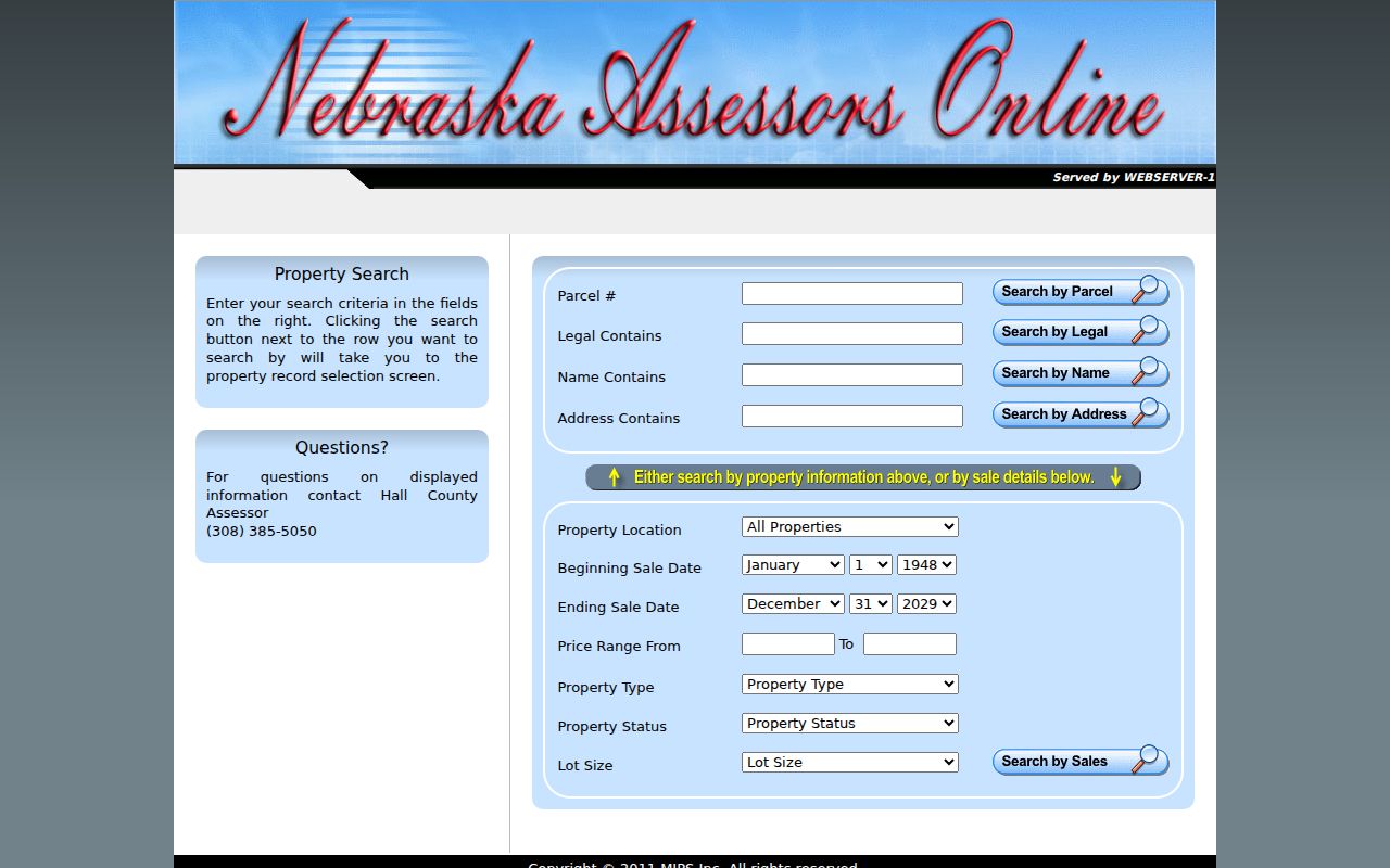
Those filters support parcel research, but the record should remain labeled as an assessment result rather than a complete title or residency finding.
Grand Island Street GIS Parcels
The parcel viewer makes a street-by-street review more concrete. Its popup exposes PARCEL, CURRENT_OWNER, LEGAL, SITUS, latitude and longitude, and area. The app also provides map navigation, Measure, Pictometry, bookmarks, print, an overview map, coordinate and scalebar tools. Layers include parcels, right of way, legal lots, easements, subdivision and lot dimensions, zoning, FEMA flood and floodway data, and utilities.
To examine nearby addresses, pan to the target and click neighboring parcel polygons one at a time. Preserve each parcel ID and situs instead of making a social inference from physical proximity. The inspected configuration did not show a documented radius or buffer selector, and no direct parcel export was identified. The GIS owner value is a source-field string, not a certified title conclusion.
The parcel feature service exposes the machine-readable field schema behind the mapping layer.
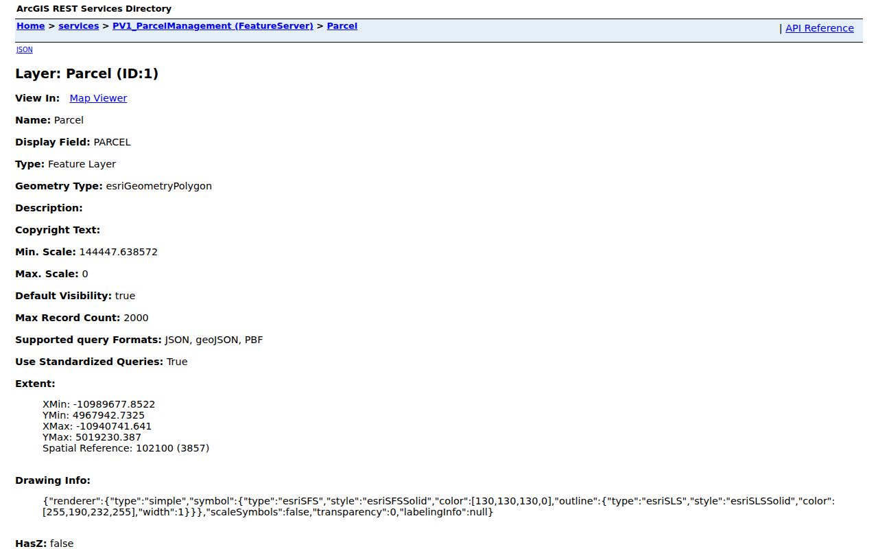
The parcel ID is the safer bridge between a map popup, an Assessor result, and a later deed search than a street name by itself.
Grand Island Address Record Routes
Each address-keyed source has a narrower job. The Assessor and GIS help locate the parcel. The Register of Deeds records land instruments. Permit and zoning files can document a project or land-use question when requested from the right office. Current voter registration is handled through a separate, purpose-limited election channel. A Grand Island street directory becomes more reliable when those records are compared by record date rather than blended into one claim.
| Address record | Grand Island or Hall County keeper | Street-level use | Access route |
|---|---|---|---|
| Assessment record | Hall County Assessor | Parcel, assessment context, sale and property filters | Online search; Assessor office |
| Parcel GIS | Hall County and Grand Island GIS | Situs, legal description, parcel ID, map layers | Online viewer and feature service |
| Recorded instrument | Hall County Register of Deeds | Deed, plat, mortgage, lien, or reconveyance trail | Online and legacy indexes; office, phone, or mail |
| Permit or zoning file | Building Inspection, Zoning, or City Clerk | Address-specific project or land-use records | Office contact or written public-record request |
| Current registration | Hall County Election Commissioner | Current registration and polling-site question | Nebraska Voter Check or election office |
A parcel number joins the parcel layers and should travel with the legal description into the deed search. The street name can be an entry point, but it is less stable than the parcel record. For historical household evidence, the directory collections are treated separately on the Grand Island City Directories page.
Grand Island Street Deed Trails
The Hall County Register of Deeds holds deeds, plats, mortgages, reconveyances, death certificates, state and federal tax liens, and related real-property instruments. Search the online index by the legal-description components when a name is ambiguous. Visible controls include instrument or index number, name-style searches, section, township, range, subdivision, block, book and page, plus a VIEW PLAT PDF control. The index aids research but does not give a title opinion.
The public Nebraska Deeds Online Hall County search and the legacy deed repository are both useful access channels. The legacy route states that instruments are available from sequence 76000002 to current. That is an instrument-sequence boundary, not a year range. If a document cannot be found online, contact the Register of Deeds rather than assuming it was never recorded.
Hall County Register of Deeds
200 S Sycamore St, Suite 6
Grand Island, NE 68801
(308) 385-5040
Office hours listed in the research: 8:30 a.m. to 5 p.m. weekdays except holidays. Copies are listed at $0.20 per page and certified copies at $1.50 per page; verify fees before ordering.
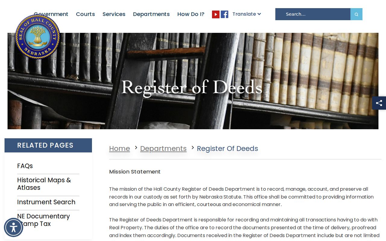
The Register of Deeds office page is the official route for instrument-search links, office contact, and records information.
For a current by-address question, distinguish the most recent recorded grantee from the GIS owner string and state the date represented by each source.
Grand Island Address Permits
No complete citywide permit-search portal was located for Grand Island addresses. Start instead with the responsible office and a precise written request. State the department, record type, street address or parcel, date range, and whether inspection or electronic copies are wanted. Ask for existing records or existing fields, not a new analysis. Under Nebraska public-record guidance, a custodian is not required to create a new index or answer a research question in a new format.
Hall County Building Inspection publishes forms for building, electrical, plumbing, sign, contractor registration, permit project details, and manufactured buildings. Its permit form uses project address, owner and contractor information, zoning, construction classification, project value, description, signature, and date. Those are useful terms to include when requesting a historical file. The City Clerk is the route for council proceedings, ordinances, resolutions, contracts, agreements, conditional-use permits, liquor licenses, and deeds.
The Hall County Building Inspection page provides the office’s public forms and contact route for address-specific permit questions.
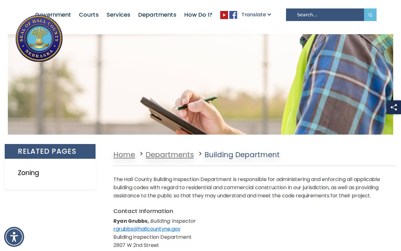
Because no public address-search portal was identified, a documented request is the appropriate fallback after the form and office route are checked.
The Hall County Zoning page is the direct source for zoning office access and related land-use information.
Zoning is at 114 S Sycamore. The research lists weekday hours of 8 to 11:30 a.m. and 12:30 to 5 p.m.; verify them before a visit. The shown conditional-use application charge is $500, while a universal permit-fee schedule and standard processing time were not located.
Grand Island Street Maps
An older address may not resolve cleanly in a current parcel map. No official Grand Island street-renumbering or street-renaming chronology was located, so pair the address with its time period. Hall County’s 1885, 1890, and 1904 atlases can show ownership labels, plats, school locations, and city or rural context. The Library of Congress 1909 Sanborn set has 24 sheets for Grand Island and can show street names, block and building footprints, construction notes, and occupancy categories.
Use the date and plate or sheet number with every map note. A map label is historical context, not current title evidence. The Hall County historical maps and atlases collection is an official online starting point, with the Heritage Room and History Nebraska serving as further research channels.
When an old number conflicts with the present-day parcel, preserve both versions and add a dated directory, census, newspaper, or permit source before treating them as the same address.
Grand Island Address Mismatches
A postal city, ZIP code, parcel jurisdiction, city limit, precinct, and neighborhood are separate geographic overlays. A mailing address that says Grand Island does not by itself establish that the parcel is inside the incorporated city. The state municipal-boundary page lists Grand Island Ordinance 9938 as effective April 1, 2024, which is another reason to use current GIS and boundary records when jurisdiction matters.
This is a common source-of-error problem. Validate the exact address with USPS ZIP Lookup, compare the GIS situs and parcel ID, check the Assessor legal or name/address record, and then search the Register of Deeds by legal description. If the four sources disagree, report the mismatch and ask the relevant custodian. Do not invent a neighborhood or city-limit conclusion from a ZIP.
- Parcel
- A mapped unit of land identified by a parcel number, used to connect local property records.
- Situs address
- The physical property address recorded for the parcel, which can differ from a mailing address.
- Plat
- A recorded map that lays out a subdivision, lots, blocks, or related land description.
- Criss-cross directory
- A reverse directory section arranged by address, used to research a household at a particular time.
Grand Island Street Directory Leads
Historical directories can add an address-based household lead, but the local year run must be confirmed title by title. The Nebraska State Genealogical Society holdings search displayed a 1993 Grand Island City Directory with call number 978.2410 GRA, and supplemental genealogy indexes identify a 1912 lead. Official local web pages did not expose a complete directory run or stable digitized items for every year.
The Heritage Room is the primary local research room for this work. It is at 1124 W 2nd St and holds Nebraska and local-history materials, genealogy resources, special collections, microfilm, newspapers, and digital databases. Materials are used in the library and do not circulate. The listed hours are Monday and Tuesday 9 a.m. to 8 p.m., Wednesday and Thursday 9 a.m. to 6 p.m., Friday and Saturday 9 a.m. to 5 p.m., and Sunday 1 to 5 p.m.; confirm before traveling.
A criss-cross entry can place a name at an address in the volume’s year. It cannot prove a present connection to that property. Verify the title and year with the Heritage Room, the Nebraska State Genealogical Society, or the FamilySearch catalog, then pair a directory hit with a dated map or census entry. That preserves the historical address trail without turning it into a current-person list.
Note: The Hall County Historical Society is volunteer-run, so contact it in advance for research or tour arrangements.
Grand Island Street Privacy Limits
A by-street search cannot reveal every household member, and it should not be treated as a general people list. DMV records are protected by the federal Driver’s Privacy Protection Act and Nebraska law. Vital records carry their own purpose, relationship, and identification requirements. Nebraska’s Address Confidentiality Program can protect an eligible participant’s actual address through a substitute mailing address and mail forwarding arrangement. It is designed for qualifying Nebraska residents concerned for their safety.
For protected-address questions, the program requires an in-person application through a designated victim-assistance center, not a direct application to the Secretary of State. For ordinary public-record questions, keep the source, date, jurisdiction, record type, and custodian visible. Do not publish unnecessary identifiers or treat a parcel, voter, deed, or directory hit as proof of identity, relationship, or wrongdoing.
Lawful use. Grand Island address records support personal, lawful research. Nebraska’s stalking statute, §28-311.03, covers willful harassment intended to injure, terrify, threaten, or intimidate; never use address material to stalk, harass, or harm anyone.